Waterlands IV
These Islands
SuperStudio 7
Professor Paul Clarke, Professor of Architectural Design
Peter McNie, Lecturer in Architecture
People nowadays think, scientists are there to instruct them, poets, musicians, artists, etc. to entertain them. That the latter have something to teach them; that never occurs to them.
Ludwig Wittgenstein (1940)
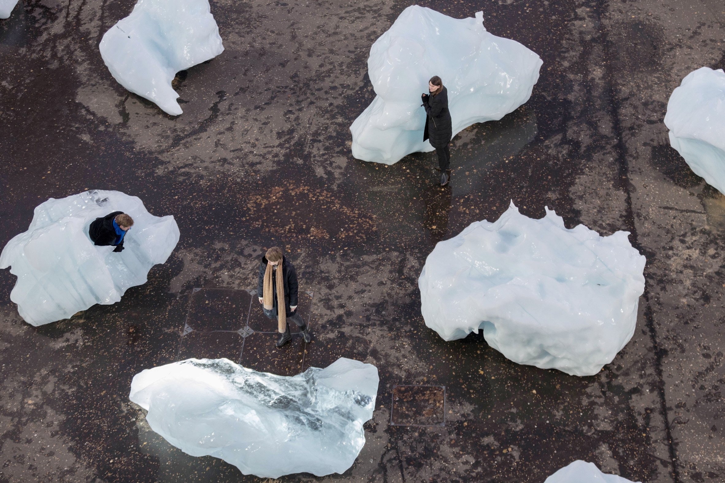
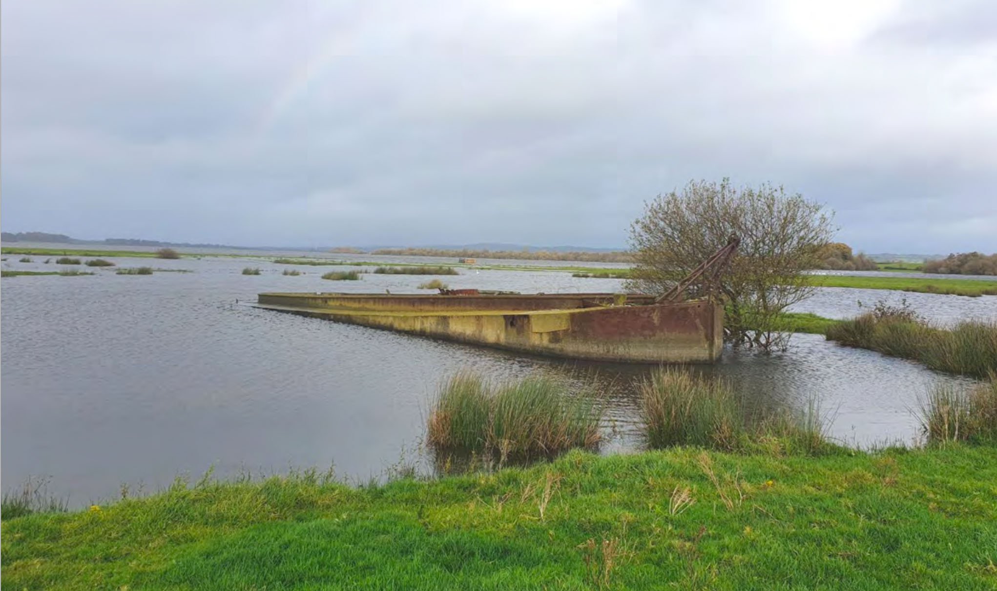
Over the past few years the WaterLands studio has explored different landscape conditions associated with water in Northern Ireland: the North Coast, Lough Neagh, Church Island, Strangford Lough, the Upper and Lower Bann and last year The Mourne Mountains and the relationship of the town of Newcastle to the sea.This year the studio will adopt a different strategy, by moving across different scales in a ‘Swiftian’ search for what constitutes an island, and the relationship between islands: an archipelago. We will ask how islands are perceived, documented, geologically formed, inhabited, drawn, and at what scale they operate? Can Islands only exist in the sea and water? Can they be inland? Can buildings be interpreted as islands? In what geographical range do islands connect? These will be some of the question the studio will explore this year. How notions of islands can be defined and in relation to architecture. They will be charted through drawing and research. This will form the basis of the studio enquiry. We will ‘collect’ islands in order to provide a context for projects to evolve. In Gulliver’s travels Lemuel sets out on a journey to discover different islands, beginning with Lilliput and ending with the island of the Houyhnhnms. On arrival at each new island his sense of relative scale or reality radically shifts each time. The traveller has to take each island on its own terms. Gulliver continually searches out new islands and new adventures.


The writer, mathematician, and mapmaker Tim Robinson in his books Stones of Aran LABYRINTH, and Stones of Aran PILGRIMAGE, maps the Aran islands and contrasts two different ways of understanding and exploring a landscape. One he calls ‘labyrinth’, in which he moves across the land in an inward spiral encountering the field patterns, roads, rocks and so on; the other he calls ‘pilgrimage’ in which he circumnavigates the island along the coastline in a clockwise circular movement discovering the inlets, channels, ports and harbours.


Taking the latter as an important influence in how we encounter an island, we aim to chart different ways of looking, interrogating, and discovering islands at different scales: cartographic, social, spatial, material, intellectual, and so on. The theme will be contextually, spatially and abstractly defined this year by the ‘journey’ to find, and between islands, with a sense of a greater collective archipelago. In defining our ‘islands’ individually and collectively, you will be asked to zoom into different layers of observation, research and mapping.
The title ‘WaterLands’ (now in its fourth iteration) is taken from one of the sections in Robert Macfarlane’s book Landmarks, -which is structured as a sort of taxonomy of journeys and conditions: Flatlands, Uplands, Edgelands, Northlands, Coastlands and so on. The book takes the form a series of episodic essays framing the individual journeys, between which are set a series of glossaries, which aim to ‘describe’ and ‘collect’ words associated with particular landscapes. This ‘mapping’ of words provides a rich understanding of the associations and sounds of the different landscapes. It is required reading for the Studio as is Unfolding Irish Landscapes (information below) and the books written by Tim Robinson. You will be required to identify you own reading and research as part of your process.
‘…Scholars, I plead with you, Where are your dictionaries of the wind, the grasses?’
Norman MacCaig 1983 from Landmarks


The term ‘pilgrimage’ adopted by Tim Robinson suggests both journey and ritual, but the etymological origins relate more specifically to that of the ‘foreigner’ travelling across lands unknown, but with a defined destination in mind. As such the gaze of the ‘traveller’, finding and following a route, and the nature of the ‘unseen’ ground, enters into the experience and ‘knowledge’ of the land. This will inform our own approach in the studio, and the landscapes we encounter. The unfolding and unravelling of these landscapes is dependant on the individual research and ‘field-notes’ taken on each ‘journey’.


We will start the year with a short architectural conversation by imagining two structures: one vertical and the other horizontal. One will be a place of retreat for a poet, the other a place of departure for a boat. Together a place to discover and register inner and outer perceptions and the relationship to an outer landscape. We will then collectively map and gather islands through making a collective drawing of an archipelagos inspired by the Surrealist map of the world. By making our own abstracted maps and drawings this will act both as a source of inspiration –in terms of the layering of ideas and to form different readings, both abstract and physical. You will be encouraged to research widely the notion of what an ‘islands’ is, and where possible to visit and record them, using different forms of media -both digital and analogue. You should be carefully recording and documenting what you see and feel. In particular keeping a notebook/sketchbook/field-notebook, like Tim Robinson, making your own notes, maps, collecting words, inspiration and making drawings as you discover the different aspects and unseen layers of a specific place, landscapes, and community.


Considering the scale, the diverse topography and geography, and the open nature of the land/water relationship of islands, the Studio will work to begin to draw, record, measure, familiarise, map and explore the extent and ‘limits’ of each territory given to each year group. At times we will consider larger landscapes before moving in closer to particular sites, contexts, buildings and fragments.
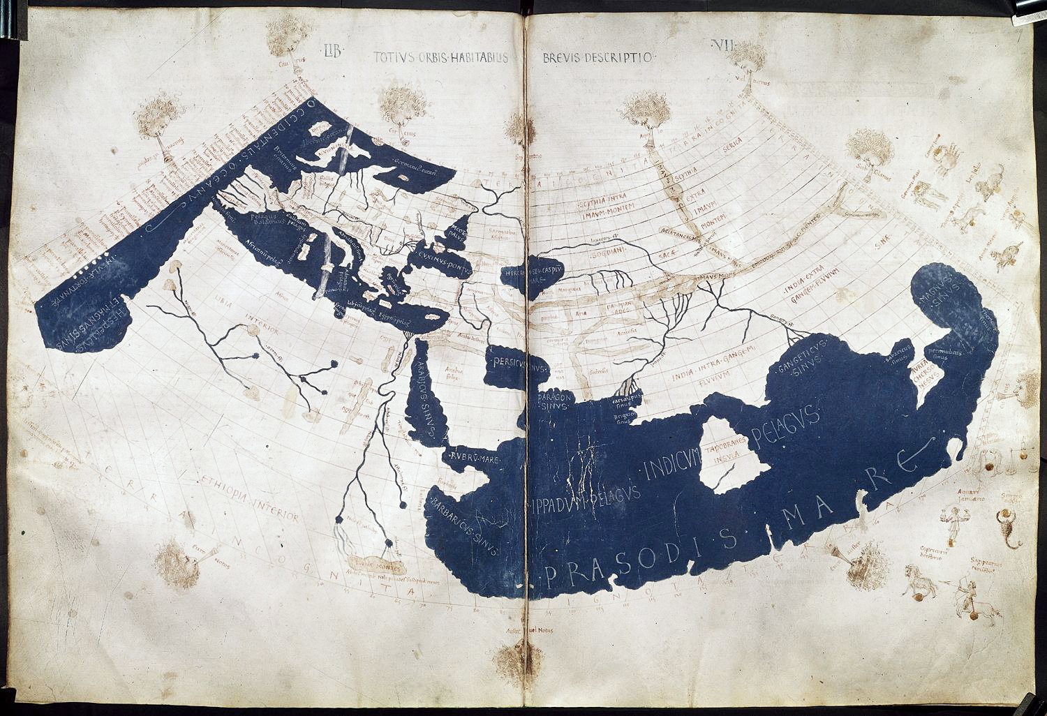
Like a surveyor discovering for the first time the land they have been asked to map, how do we begin to understand it: qualitatively, quantitatively, historically and spatially? How do we ‘measure’ it? What is embedded deep in a physical landscape, in its history, its names, its settlements, and its people? Can and should this be done by walking it, studying the maps, speaking to people, or reading about it, are all of these? Place names, rock features, settlement patterns, roads, and so on, are all part of the layers and traces of meaning and memory that need to be understood? Critical to this process of looking and interpreting each landscape, is the dialogue between that of land and water, as it moves from the height of the mountain to finding its own level at the sea. Humboldt’s drawing below reveals an ecology of height and gravity on an island which was once a volcano.

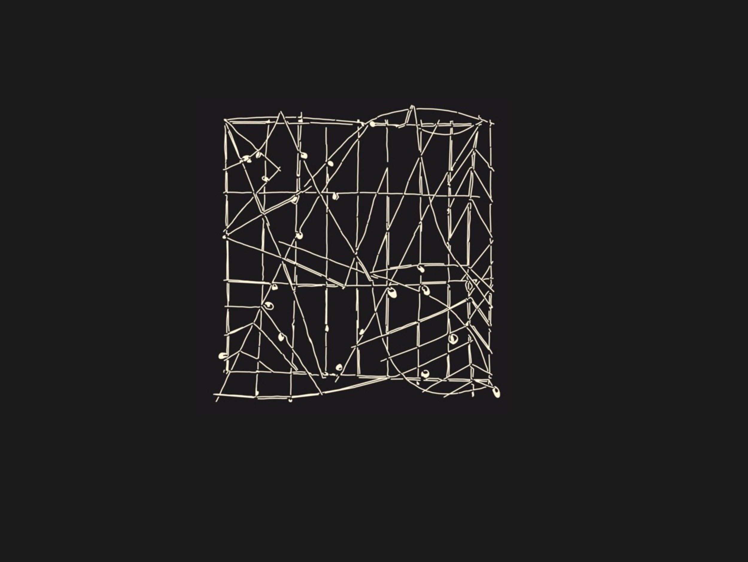
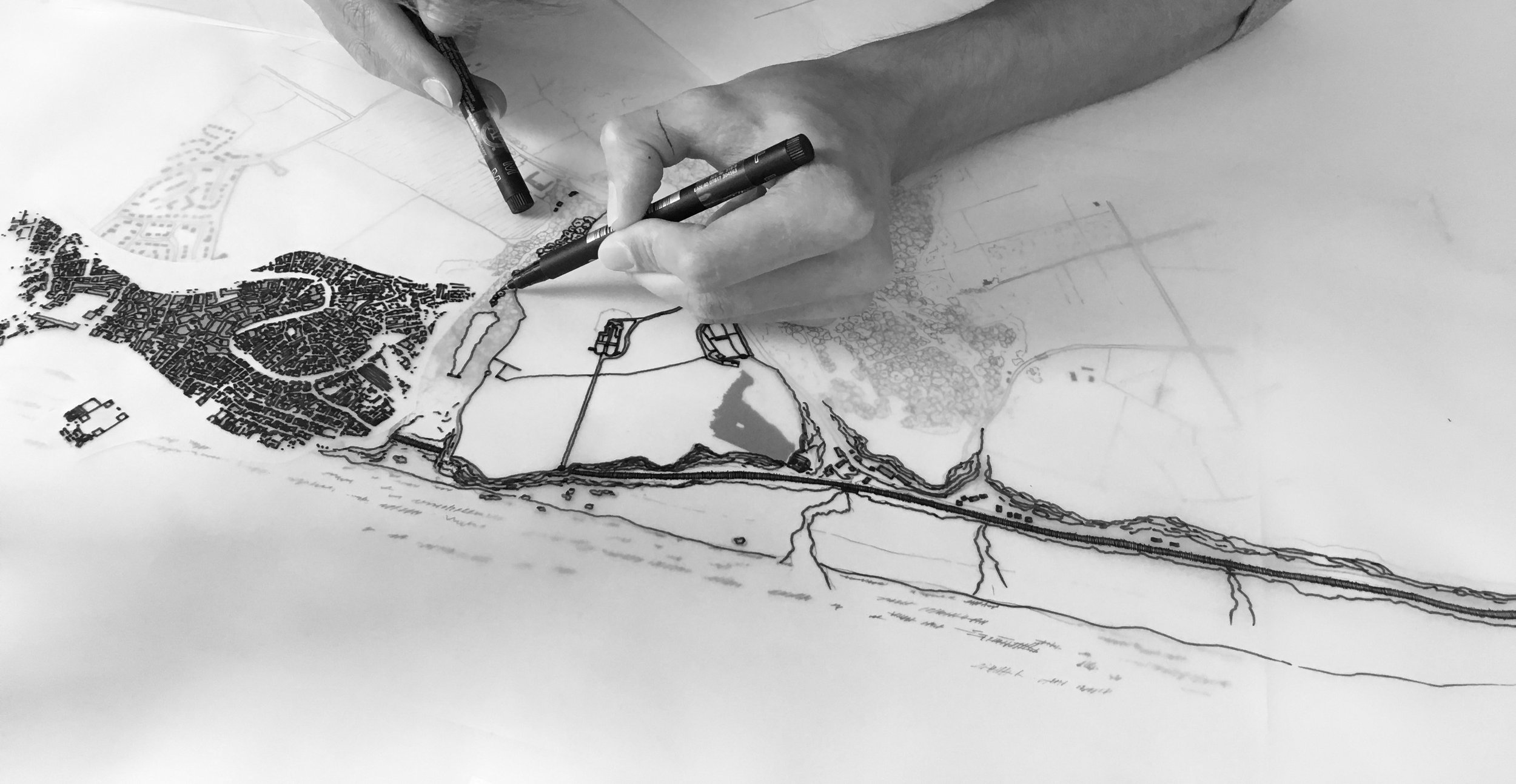
Ranging from the scientific to the surreal, drawings and maps will be discussed, studied and invented, while the essential tools of architectural drawing -plan and section- will be deployed and explored. Thinking and drawing at different scales will be part of the working methods of the studio. Drawing is considered as our research methodology. Questions of why and how drawings, maps and diagrams are made; how they are used and interpreted by different people such as geographers, architects, artist, archaeologists, and so on will be considered. Drawings and the interpretation and reading of them, will form a key part of the approach and working methods of the studio. Drawings will be made both individually and collaboratively, digitally and by hand. Drawing will become the ‘language’ of the studio.
The work of the studio is directly related to the ARG Research Cluster.
We will gather and discuss different practices of drawing over a wide range of historical periods. You are encouraged to read widely on the different practices of drawing and to collect examples that inspire you. Robin Evan’s essay Translations from Drawing to Building will act as an essential primer to begin discussions on how drawings function, the act of translation in making them, and considering the space between drawing and building. Over the year we will explore how different drawings can be used and how drawing can become a personal voice in helping to position your own work and approach. The overlap between maps and architectural drawings will be explored in what we will call a search for the cartography of drawing. Drawing will act as a form of thinking, as an automatic action, as a performance, as a way to engage both the hand and eye, in the shaping of ideas and perceptions of space, material and light, and of things half-seen or imagined. Scale, and the zooming across different scales both digitally and intellectually will become important in our research and projects. Mapping, drawing and design become intertwined as both process and practice.

Charles and Ray Eames Powers of Ten https://www.youtube.com/watch?v=0fKBhvDjuy0
Drawings should be explored on both horizontal and vertical surfaces. Like a shifting territory itself, a drawing should be discovered as a space to explore, to map as you proceed and to make our own.
The cartographers of Jorge Luis Borge’s tale On Exactitude of Science were faced with a dilemma of drawing and scale: how to map the contours and spaces of their territory, when with each new drawing the lines and shapes became equivalent to that of the actual city and landscape itself? The drawing and the physical land had now merged into one. Inspired by this we will explore how the processes of drawing at different scales and projections can reveal a personal topography of looking, and a propositional field for ideas and projects.
On Exactitude in Science
In that Empire, the Art of Cartography attained such Perfection that the map of a single Province occupied the entirety of a City, and the map of the Empire, the entirety of a Province. In time, those Unconscionable Maps no longer satisfied, and the Cartographers Guilds struck a Map of the Empire whose size was that of the Empire, and which coincided point for point with it. The following Generations, who were not so fond of the Study of Cartography as their Forebears had been, saw that that vast Map was Useless, and not without some Pitilessness was it, that they delivered it up to the Inclemencies of Sun and Winters. In the Deserts of the West. still today, there are Tattered Ruins of that Map, inhabited by Animals and Beggars; in all the Land there is no other Relic of the Disciplines of Geography.
purportedly from Suárez Miranda, Travels of Prudent Men, Book Four, Ch. XLV, Lérida, 1658
Jorge Luis Borges, Collected Fictions, translated by Andrew Hurley.


We will specifically focus our work this year around the notion of the island: of that of land and water; of land and space; and through inhabitation and use. Charted through the figural and narrative dimensions of drawing, as well as the extensive digital capacity to zoom in and out ( refer Eames powers of ten film) of the actual landscapes in google earth, as towns, roads, datascapes, measured studies, historical maps and so on. We will consider all drawings as a physical and material thing in itself. We will seek-out ideas in the ‘thicknesses’ of the map and drawing.
Each of the studio year groups will be set different tasks and different locations, but which collectively relate to the wider themes and investigations of the Studio. You should carefully collate your own work and ideas as well as group projects, to capture your perceptions, influences, and observation, on a daily basis in your own WaterLands notebook: Your own WaterLog. Over the year there should be a number of these.
Historically water was the easiest means of transport, as there were few roads, thus the notion of the ‘Sea Roads’. Water connected people. Often these were ‘mapped’ only in the minds of travellers ( refer to the tide diagram at the start of this text) and maritime people who developed an instinctive sense of place, movement and location, which with our technologies of GPS and Google maps may seem surprising to us Today. If we think of the maps we first encountered as children in our school atlas: the blue of the seas and oceans, the names of the rivers, the green of the land, the brown of the mountains, we discover our intuitive knowledge of places through maps.

The work of the Studio will be organised around the balance of individual and group work with specific projects dedicated to each year groups. Collectively our work will be considered as an abstracted landscape within which -like Borges cartographers- we aim to unravel and explore a dialogue of projects in specific contexts and through thinking across different scales. Drawings act as maps through abstraction of both the physical territory of study and our own experiences and imagination.

The ground has memory
There will be many questions:
How do we perceive and imagine architecture through drawing?
How do different types and methods of drawing create new insights?
Are we drawing what we know, or drawing to discover what we don't know?
Is drawing simply a form of communication?
How does the method of drawing inform what we are thinking and making?
Primary aims and objectives of the Studio:
To explore the landscape of Northern Ireland (physical and abstracted) under the thematic title of WaterLands, and to research this ‘territory’ through a series of different year based projects, studies and individual building proposals.
To utilise drawing as the primary investigative, communicative and expressive tool and as the central research methodology of the studio.
To develop, nurture and build throughout the year inter-peer learning and dialogues focusing on specific subject skills, creative and imaginative solutions, creative risk taking, critical positions and in developing reflective abilities.
To support and nurture collective working practices, outputs and collaborations that will set the context for independent learning and future architectural practice.
Drawing will be used as a critical ‘toolset’ in order to define and encourage different readings: of landscapes, spaces, objects, buildings, materials, processes, layers, movements and social patterns, in the context of the given sites and locations.
While drawings may be associated as primarily about communication and information and visual representations of form, they are also abstractions of social and political meaning, with different positions of authorship, power and control. As Picasso has said of his own drawings “…they can be both Innocent and devious….”.
Central to all the work in the WaterLands IV SuperStudio will be developing YOUR OWN critical ‘position’, and ‘voice’, engaging fully in the studio discussions, reviews and workshops. As the studio has students across different year groups you will be expected to help mentor, encourage, inspire and support each other in developing a creative, disciplined and energetic studio. In particular full attendance on studio days (Tuesdays and Thursdays) is critical.
Together we will:
Explore and discover the unique nature of what and ‘Island’ and how it can be explored and defined.
Use drawing as an investigative, imaginative and critical tool for proposing architectural ideas, urban designs, details, and recording and researching places, spaces and communities.
Encourage, debate and develop different individual approaches to architecture and design.
Explore different aspects of scale: between objects, people, rooms, buildings, and landscapes.
Reference key aspects of history and fine art as inspiration to inform the work.
Consider social needs, the specifics of place and climate, and the nature communities and contexts.
Develop ideas through a rigorous and considered process.
Explore projects through all levels of detail with an emphasis on technology, construction, climate change and sustainability.
Structure and develop individual work within that of a larger collective theme and evidence meeting the Learning Outcomes and the ARB/RIBA Criteria through a comprehensive individual portfolio of work at the end of Semester 2
STUDIO RESEARCH STATEMENT
Research Questions and Theme
By considering the territory of architectural drawing as a culturally situated practice, and as a multifaceted methodology of research important insights into the different ‘landscapes’ of personal, professional and educational creativity are explored. What are the different ways drawings are produced, and who for? What dimensions do drawings offer in architecture beyond that of a quantitative commodity? Within this wider research area the work of the studio explores limits, frames and translations across scale, place and narrative. The ‘enabling fiction’ of drawings, described by Robin Evans, allows for a multiplicity of practices, a diversity of media, and non-linear explorations of compositional and creative strategies. Drawing is considered as its own material substance. The physical contexts explored in the studio are directly related to differing aspects of water across the Northern Ireland landscape, both in physical and narrative terms, as rivers, coastlines, bogs, hydrological cycles and ecosystems, while also being considered as abstracted maps, waterlogs, collages, timepieces, and so on.
Description and Methods
Drawing as a register of meaning evidences a multiplicity of philosophical, physical, qualitative, quantitative and phenomenological and operational tactics in architecture, with drawing as the primary ‘currency’ of the profession. The studio work aims to explore and unravel: the translatory space of drawing; the cognitive connections between hand and eye; and an exploratory dialogue between hand drawing and digital means. Through considering this space between the digital and the analogue, and between the idea and the building, this research aims to situate and contextualise different intellectual positions and knowledge constructs within a wider cultural and social framework analysis.
Findings and Dissemination
By recording and documenting the multiple practices, and different mediums of drawing, and in particular by examining the relationship of drawing within architectural education, this research aims to uncover new insights through and on drawing while developing and consolidating existing work in this field, such as the documentary film Drawing on Life, the travelling exhibition The Secret Laboratory and the publication and folio of drawings Notations. Dissemination is by studio exhibition, publication and symposia.
PROJECTS AND INSPIRATION


GROUP PROJECTS OVERVIEW
SEM 2
WK 1 A Cartography of Drawing
WK 2 Strangely Familiar
WK 4 Projects — Year Specific
SEM 1
WK 1 Tower and Pavilion
WK 3 Islands and the Archipelago
WK 5 Projects — Year Specific
WK12 Portfolio Review and Feedback
END OF YEAR PORTFOLIO SUBMISSION
NOTE. Other short group tasks may be set during the year.
Some Principal Source references
The area of architectural drawing, representation and mapping is large one but in terms of possible references and sources for now, here are a number of selected sources not in any specific order of relevance:
A History of the World in Twelve Maps by Jerry Brotton. Penguin Books. 2013
From Here to There. Kris Harzinski. Princeton Architectural Press. NY 2010
Landmarks by Robert MacFarlane. Penguin Books. 2015
The Living Mountain by Nan Sheppard. Cannongate Books Ltd. 2011
Notations. Edited by Paul Clarke and Peter Maybury. Gall Editions. 2016.
Stones of Aran: Pilgrimage by Tim Robinson. Faber and Faber 1985
Translations from Drawing to Building by Robin Evans. AA Publications 1996.
The Hand of the Architect by Francesca Serrazanetti and Matteo Schubert. FAI 2009
Why Architects Draw by Edward Robins. MIT Press. New Edition. 1997
Where You Are? A book of maps that will leave you completely lost. Published by Visual-Editions.com. 16 Writers, Artists and Thinkers. http://visual-editions.com/where-you-are-by-16-writers-artists-thinkers
You are encouraged to make full use of the library and to use as wide range of sources as possible. Please consult with your tutors on additional possible sources.
STUDIO DATES
All general dates are as set out in the year timetable by the Course Director
Intro: All studios Thursday 16th Sept 2021.
Teaching days: Tuesday and Thursday
Reviews: Generally these will be as ongoing Pin Up/PDF/submissions on a year group basis, but with dedicated Master Crit reviews in each semester. Studio Final Reviews in Week 11 will be followed by a portfolio feedback session in Week 12
Portfolios: Formative Portfolio Reviews and Feedback sessions will take place at the end of each Semester 1 with a Summative Portfolio review and final assessment at the end of Semester 2.
ASSESSMENT CRITERIA
All Studio assessment will be 100% by portfolio at the end of Semester 2. This will be assessed on the basis of the Project Assessment Chart ( supplied separately) which shows a combination of individual and group work, specifically in relation to each year’s Learning Outcomes and the RIBA/ARB shared criteria as identified in the project briefs. The Assessment chart shows all projects and their assessment weightings and Learning Outcomes. Please note the technology framework which is incorporated into this with specific weightings related to technology.
TECHNOLOGY
A fundamental part of all the studio work is the understanding and application of technology. Each semester will have a percentage waiting of technology which will be specifically assessed and which needs to be evidenced in project work. Aspects such as construction, structure, energy, orientation and passive strategies, material choices, the integration of services, and wider issues of addressing climate change, all of which should be critically appraised and alternatives shown in the portfolio.
SUPERSTUDIO
Students should work in the designated space of the WaterLands Superstudio to fully engage the studio culture and the collective effort required for the research, fabrication of models and presentations and most importantly discussions. It is important to note specific COVID 19 protocols for studio occupation. This will be discussed at the introduction to the studios and must be followed. Attendance is crucial, both for a good working ethos in the Studio, but also vital to engage the wider debates, and the energy and discussions that take place across the other studios in the school. On the defined studio days students are expected to be in attendance ( as defined by your tutors during COVID 19 regulations and protocols). It is important that you discuss in advance with your tutors any issue of non-attendance.
PROCESS WORK AND PORTFOLIO
A key part of what you do in the SuperStudio is recording and charting your process work: the thinking, the studies, research, the testing of ideas in models, etc. This illustrates your working methods and development. This is a key part of your assessment at the portfolio review, and as such is a diary of how your work is progressing, and which shows the rigour of your thinking throughout the year. It is essential that you chronologically structure your process work as you go, for your portfolio, and that you compile, curate and photograph models and sketches. Do not leave this until the end of the year. Your portfolio is your complete ‘diary’ of your day by day, week by week progress. Sometimes this will be in the form of a particular submission pin-up, but otherwise it could take the form of sketchbooks, overlays, studies, etc. At each stage we will expect to see evidence of your process work and thinking. Your final portfolio submission will require to show all process and development work.
WATERLANDS PROJECT NOTEBOOKS
As a particular requirement of this studio is that each student is expected to keep notebooks/ sketchbooks/WaterLogs of drawings of your thoughts, studies and ideas on a daily basis, and which which will become part of our ongoing conversation and end of year exhibition.

TUTORIALS
These will be held either on a weekly basis every Tuesday and Thursday. In order to get the best out of your tutorials or group discussions your material should be worked out in advance and structured in a clear order with drawings, models, relevant research material printed or as a single pdf and the issues you want to be discussed identified.
Specific references such as precedents and case studies will be given during the various project stages and tutorials but the following give some examples of drawings and approaches which will be useful to begin our conversation. You should constantly gather a wide range of your own source material, references and inspiration throughout the year and collate this in your own journals.
For more information on this SuperStudio, please contact Paul Clarke